Weather

The Big Picture – Frozen Style

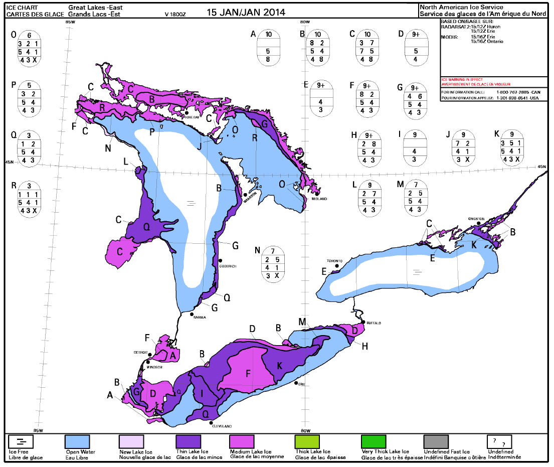
If you are wondering about the big picture, here’s a plot of ice coverage over the eastern Great Lakes as of January 15, 2014. I found it yesterday after posting the photo from Belvedere Hill. Click on the image and you will be able to see the legend which makes things pretty clear. Here’s the link to the site from where the map was taken. (The map you see below is #5 on the list if you follow the link.)

When you click on the image below you can see the Big Sound is in what’s considered ‘Medium Lake Ice’, which thins out until you hit the larger part of Georgian Bay. Lake Erie appears to be ‘blessed’ with even more substantial ice coverage than Georgian Bay. (JB – Communications Officer).

Ice_Coverage_Thickness_2014-01-15

Great Lakes Data Resource

I was provided information by Gerry Shipman of Sound Boat Works and a squadron member concerning ice coverage maps for the Great Lakes a month ago, and promptly forgot about it.

With a little bit of digging I’ve managed to find the site the map was sourced from at the NOAA (US – National Oceanic and Atmospheric Agency). This site has lots of other information that will be of interest to squadron members including winds, waves, surface currents and much more.

There is also specific information on Lake Huron including Georgian Bay. I’ve pasted a screen clipping from one of the composite Lake Huron pages. If you go to the page you will be able to click on the individual maps for a larger image and more detail. It’s worth a look. I’ve placed a link directly from the image below to the corresponding web page in case you want to take a closer look.

NOAA_GL_Snap